Overview
The find vehicle report is used to determine which vehicles were in an area at a given time. The report can be used in two ways:
- If one address is given the report will list the vehicles that were near that address in the given time period. This is useful when no other information is available.
- If two addresses are given the then report will list the vehicles that were near both addresses in the given time period. This is more useful when trying to determine which vehicle did a particular trip – for example when trying to find the vehicle that picked up at the airport and took someone home.
The report is often used to answer queries from the Police. It can also be used for lost property queries.
See also: Route Map Report.
Information required
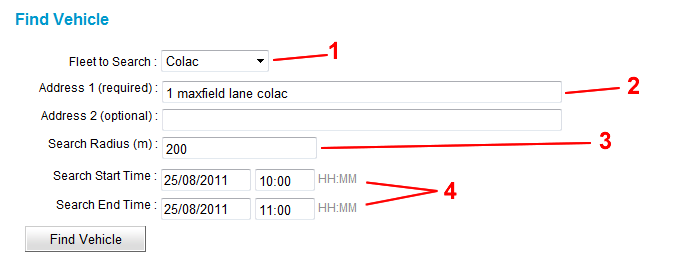
Select the fleet (1) then enter one or two addresses (2). The addresses need to be addresses that Google Maps recognises. If two addresses are given a vehicle must have been near both addresses in the period given to be included in the report. Enter the maximum distance to be used to determine if a vehicle is to be included in the report – any car that is within that distance of either addresses will be a candidate for the report (3). Finally select a start and end date/time for the report (4).

Report
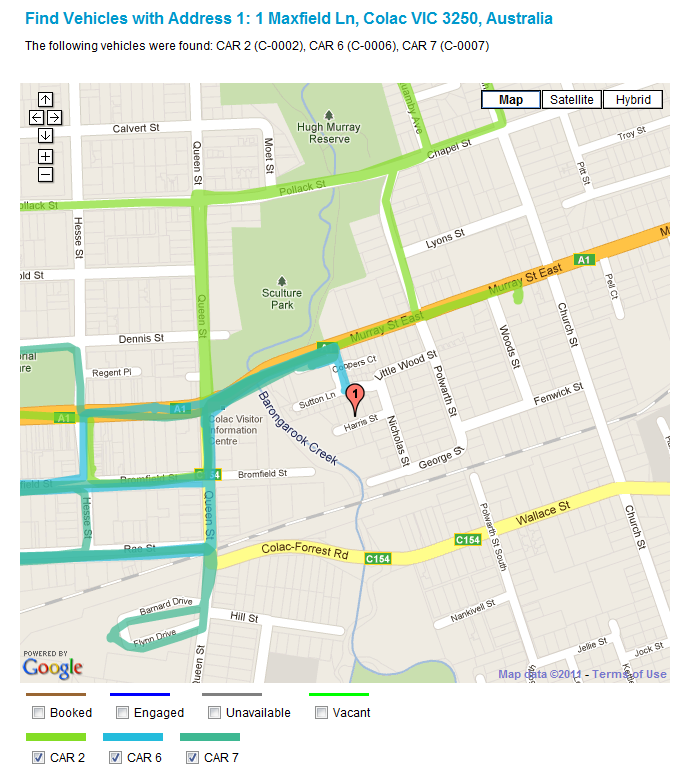
The report lists the vehicles that met the criteria given. A map is drawn showing the path taken by each vehicle. Use the Route Map report to find out more information about the route taken by a vehicle.
